The biggest winter storm of the season dumped quite a bit of snow on Iowa Friday, but we’re not done with the impacts just yet! High winds and sub-zero temperatures are expected this weekend.
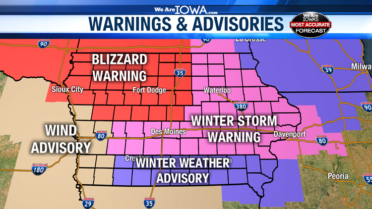
Due to the threat of blowing snow, Blizzard Warnings, Winter Storm Warnings and Winter Weather Advisories remain in effect through 6 pm Saturday across most of Iowa.

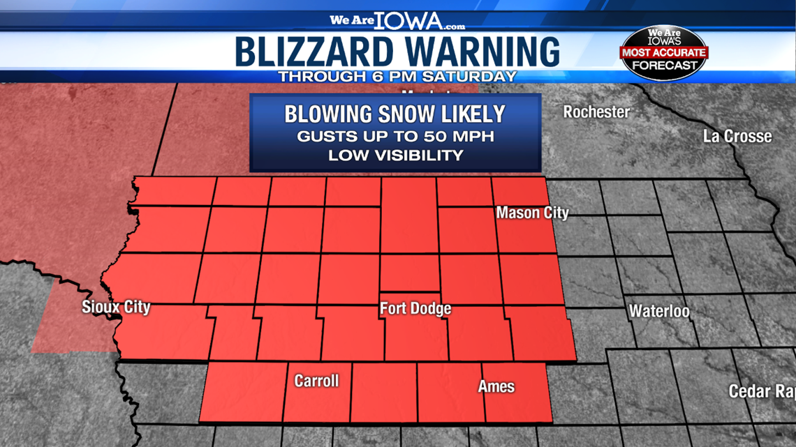
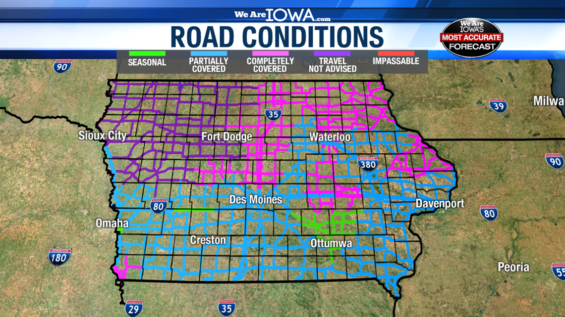
Even though the snowfall is finished, travel will remain dangerous on Saturday especially in northwest Iowa. Wind gusts up to 50 mph have already been reported across much of Iowa Saturday morning and will remain possible through the afternoon. Blowing snow will create low visibility and may drift snow back onto roads especially in rural locations.

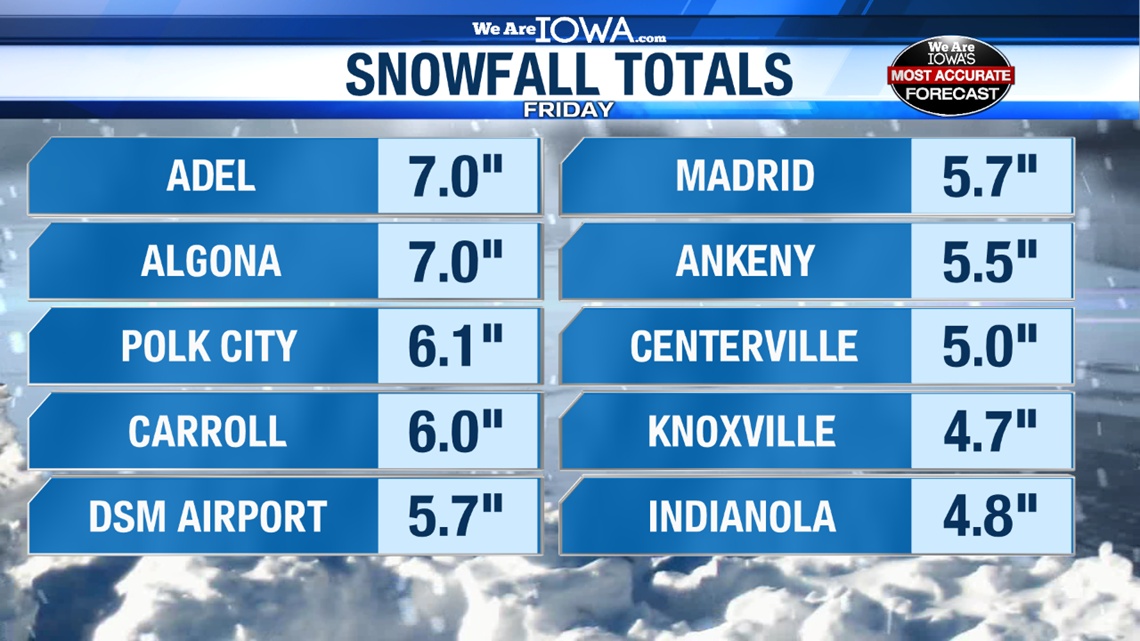
From Friday’s snow, most of central Iowa received 4-7″. Some light ice was reported in southern Iowa as well.
The official total for Friday’s snowfall was 5.7″ at Des Moines Int’l Airport.

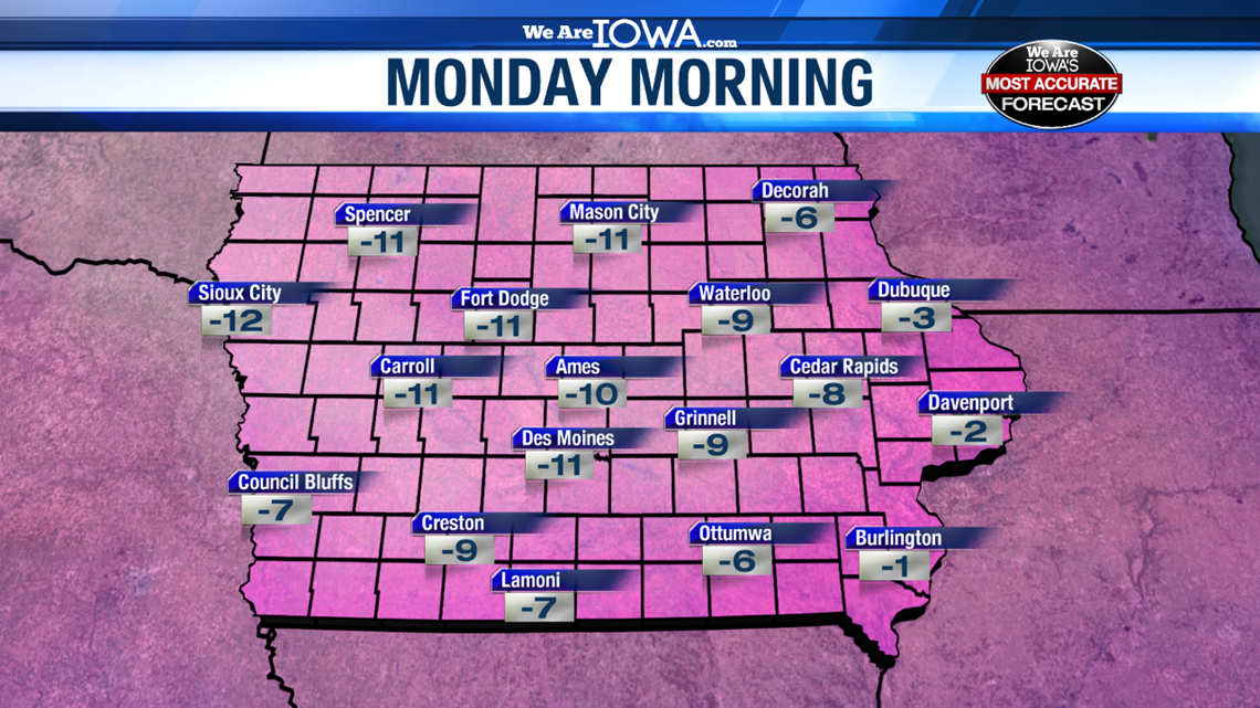
The other big story is that temperatures will plummet this weekend through early next week. Highs on Sunday and Monday will likely be in the single digits. Saturday night, Sunday night and Monday night lows will likely be below zero. This means wind chill values will drop into the -10s and -20s. This is dangerously cold, so please avoid spending too much time outside if at all possible.

Stay tuned to Local 5 for the latest forecast updates.
Download the We Are Iowa app in the App Store or Google Play Store