
IOWA, USA — Editor's Note: The video above is from Feb. 17. Read more here.
Iowa's population grew in pockets around the state’s largest cities over the past decade while 68 counties in rural areas lost population, according to U.S. Census data released Thursday.
The biggest population gainers were the counties around Des Moines in central Iowa, Cedar Rapids and Davenport in eastern Iowa, and Sioux City in the northwest.
The fastest-growing area in the state remained Dallas County, west of Des Moines, which grew 50.7% in the past decade to a population of 99,678 in 2020 from just over 66,000 in 2010.
The data shows four counties — Johnson, Polk, Warren and Story — grew by more than 10% and 26 counties increased by less than 10%. The remaining 68 counties lost population.
Statewide, Iowa's population increased by 4.7% to 3,190,369.
The state’s Hispanic or Latino population grew to 6.8% from 5% in 2010 and the Black population increased to 4.1% from 2.9%.
The white population in Iowa in 2020 was 82.7% of the population, down from 88.7% in 2010.
The least populous county is Adams County, in southwest Iowa, which has 3,704 people — a decline of 8.1 %, or 325 people, over the decade.
Polk County had the most people with 492,401, a 14.3% increase, or 61,761 people. It is also the most densely populated with 860.5 people per square mile.
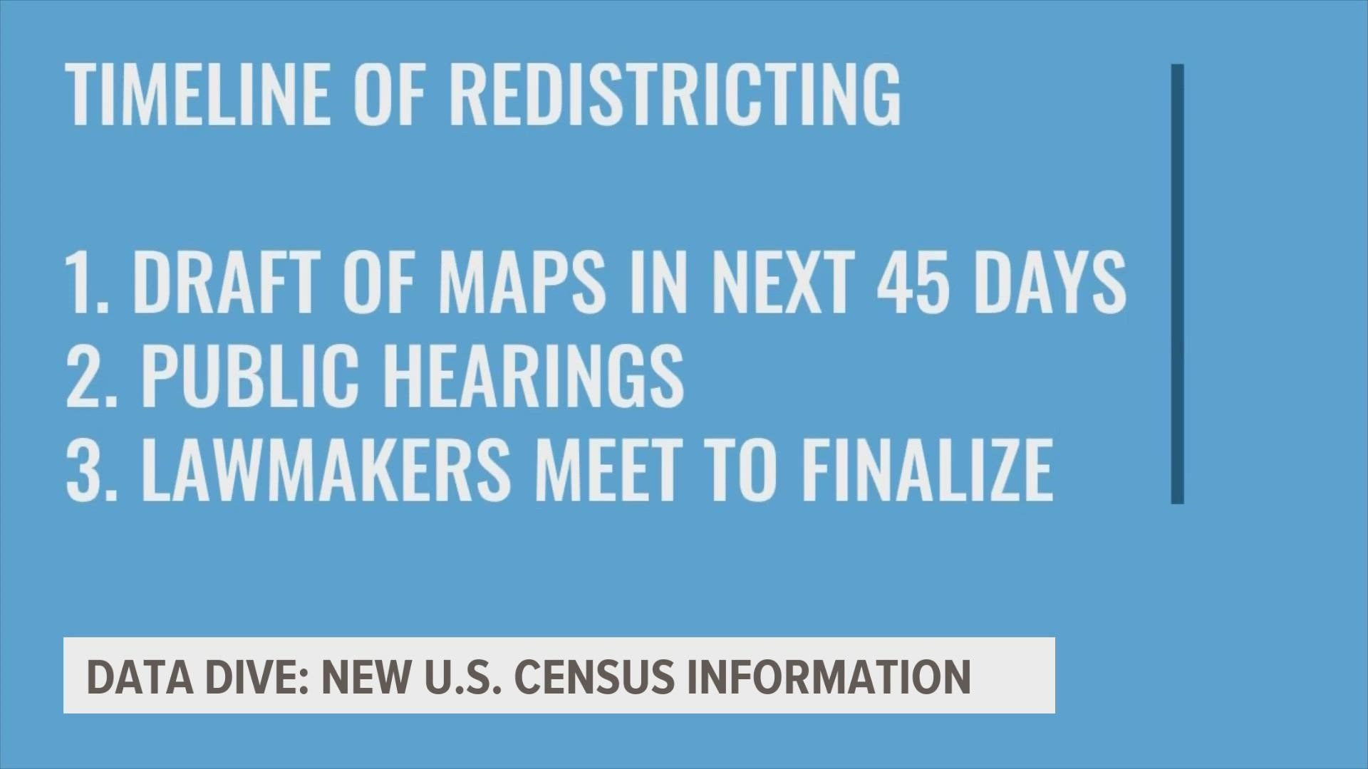
Iowa lawmakers will use the new data to redraw the state's political boundaries, a nonpartisan process that begins with the state's Legislative Services Agency. State law requires a first draft of proposed maps within 45 days, followed by public hearings and a report to lawmakers.
“After months of unnecessary delays, the Census Bureau has finally provided the data Iowa needs to redistrict the state,” said Iowa Senate Majority Leader Jack Whitver, an Ankeny Republican. “I look forward to following the nationally recognized, nonpartisan process established (in Iowa law) to create congressional and legislative districts for the next decade.”
The release of the redistricting data culled from the 2020 census comes more than four months later than expected due to delays caused by the pandemic. The redistricting numbers states use for redrawing congressional and legislative districts show where white, Asian, Black and Hispanic communities grew over the past decade.
It also shows where populations have become older or younger and the number of people living in dorms, prisons and nursing homes. The data covers geographies as small as neighborhoods and as large as states. Another set of data released in April provided state population counts and showed the U.S. had 331 million residents last year, a 7.4% increase from 2010.
Associated Press reporter Grant Schulte contributed from Omaha, Nebraska.
Watch: A closer look at the Census and what it means for American politics