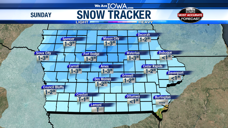
Sunday started off dry across Iowa, but light snow is beginning to spread into the state as of Sunday afternoon. Snow showers have started in northwestern Iowa, but they’ll continue to filter into central Iowa through the late afternoon and early evening.
This snowfall should be fairly light, but totals in central Iowa could get up to 2″ in some spots, while totals across northern Iowa could reach up to 3″ in a few areas. With breezy conditions, visibility could be reduced at times during the snowfall. Expect roads to become slick throughout the evening once again.

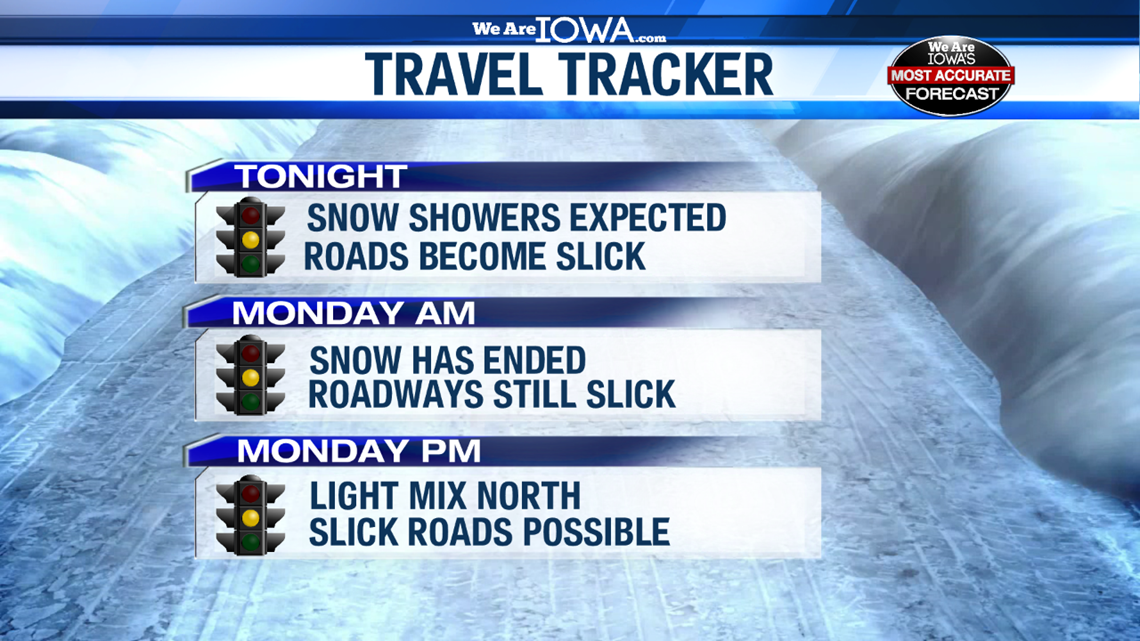
Once this system exits the state, we’ll see a few other opportunities for light snow or a wintry mix in the upcoming work week. One shot will impact northern Iowa on Monday evening and early Tuesday morning. Another light mix is possible on Wednesday.
Finally, a bigger winter storm could potentially impact Iowa again next Friday. Details on these events are still a bit unclear, but our team will keep you updated.
Remember, Local 5’s weather team is committed to keeping you safe and informed. You can follow us anytime on Facebook and Twitter for the latest forecast updates.
Download the We Are Iowa app in the App Store or Google Play Store