TAMPA, Fla. — While Isaias weakened into a topical storm Tuesday morning, it is still bringing strong winds, heavy rain and a tornado threat to parts of the east coast.
A tornado watch has been issued for several major metropolitan areas, including New York City and Philadelphia, as Tropical Storm Isaias travels up the East Coast.
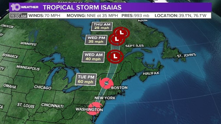
At Noon Tuesday, Tropical Storm Isaias was located 10 miles west-southwest of Wilmington DE, or 35 mi west-southwest of Philadelphia with maximum sustained winds of 70 mph.
Isaias was moving to the north-northeast at 35 mph. Wind gusts of 40-60 mph are moving into the New York City area Tuesday afternoon.
Isaias made landfall as a Category 1 hurricane around 11:10 p.m. Monday near Ocean Isle Beach, North Carolina, as an 85-mph storm, according to the National Hurricane Center.
Forecasters said a weather station at Oak Island, North Carolina, reported sustained winds of Category 1 hurricane strength at 76 mph, with a gust to 87 mph. Reports from the coastline included impacts from heavy rain, high winds and big surf.
Isaias is forecast to continue up the East Coast into the mid-Atlantic states Tuesday and the northeastern states Tuesday night. Tropical storm warnings continue all the way up into Maine.
FREE 10 TAMPA BAY APP:


►Stay In the Know! Sign up now for the Brightside Blend Newsletter