
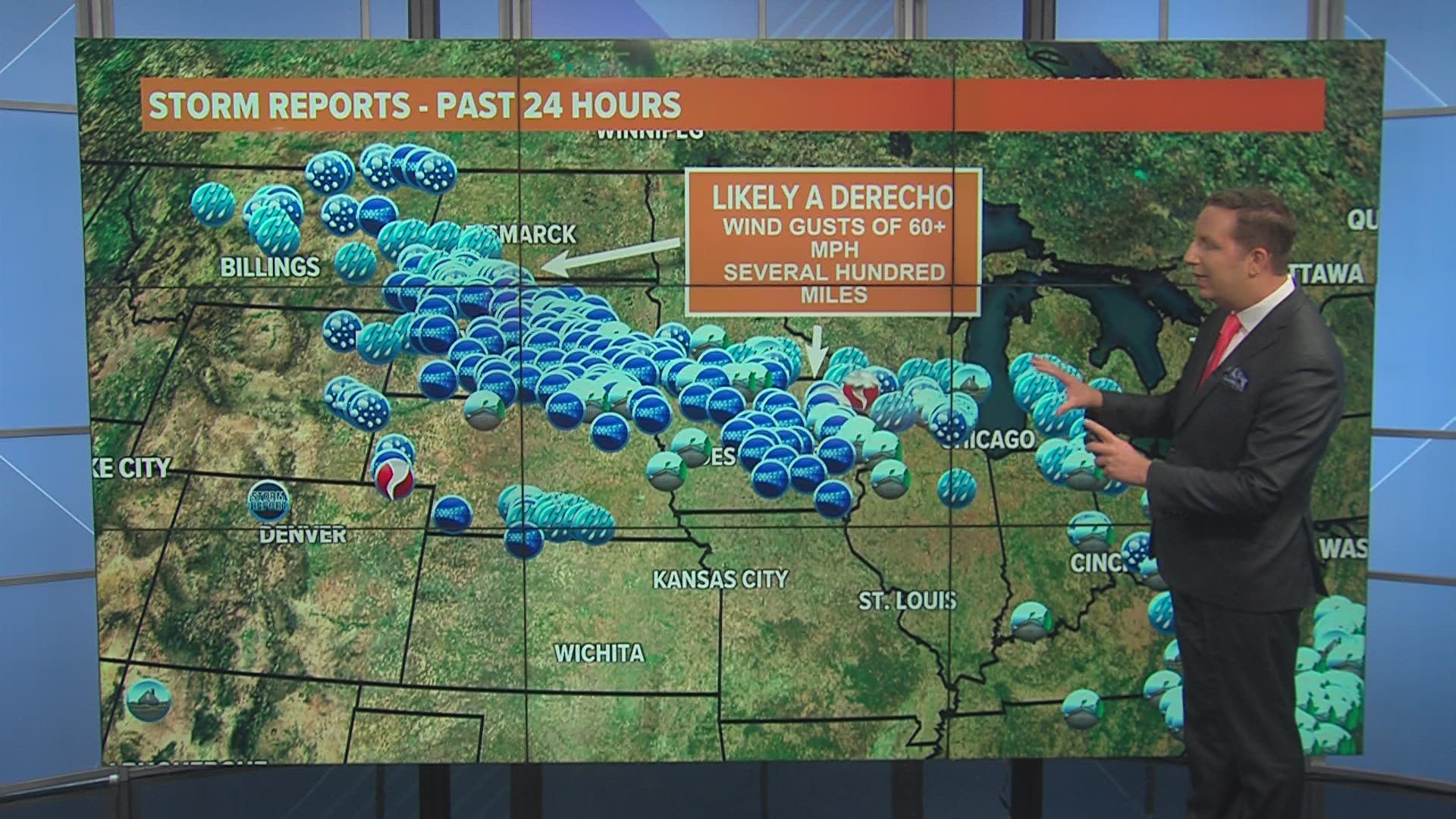
DES MOINES, Iowa — Severe thunderstorms roared from northwest to southeast across Iowa Tuesday afternoon and evening, bringing intense wind gusts and torrential rain to many areas of the state.
The storm complex began early Tuesday near the North Dakota and South Dakota border, but extreme heat and humidity across the Midwest fueled the storms for hours until they eventually weakened over Iowa.
The National Weather Service and National Storm Prediction Center on Wednesday Morning confirmed Tuesday's storms were part of a derecho, which is a long-lived wind storm that produces severe wind gusts for at least several hundred miles.
In several of their forecast discussions issued Tuesday afternoon and evening, the Storm Prediction Center referred to the storms as a "progressive derecho-producing MCS" (MCS is short for a mesoscale convective system).
Specific criteria have to be reached in order to label a storm complex as a derecho:
- The swath of wind damage must extend more than 250 miles, producing wind gusts of 58 mph or greater along most of its length
- It must also include several, well-separated 75 mph or greater wind gusts
- The damage path also needs to be greater than 50 miles wide
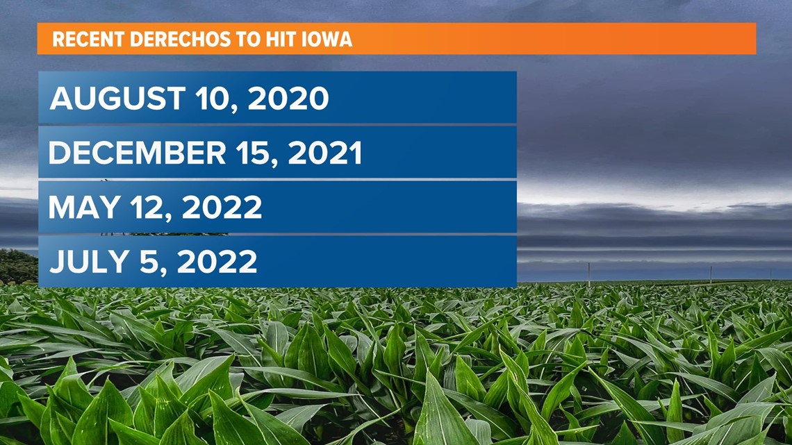
This is the fourth derecho to impact Iowa over the last few years, with previous derechos occurring on Aug. 10, 2020, Dec. 15, 2021, and May 12, 2022 (far northwest Iowa).

Although it seems like the term has been used more frequently in the last few years, they are not new types of storms and they're not uncommon in Iowa.
In fact, Iowa State Climatologist Justin Glisan says Iowa experiences one derecho every two years, on average.
Tuesday's storm complex weakened considerably as it moved into Iowa, as it produced wind gusts higher than 95 mph in parts of South Dakota.
The highest wind gusts in Iowa occurred in the northern part of the state:
- Clear Lake: 68 mph
- Algona: 64 mph
- Forest City: 59 mph
- Iowa Falls: 59 mph
- Gruver: 58 mph
- Manson: 57 mph
The storm also produced heavy rainfall across much of central and northern Iowa.