
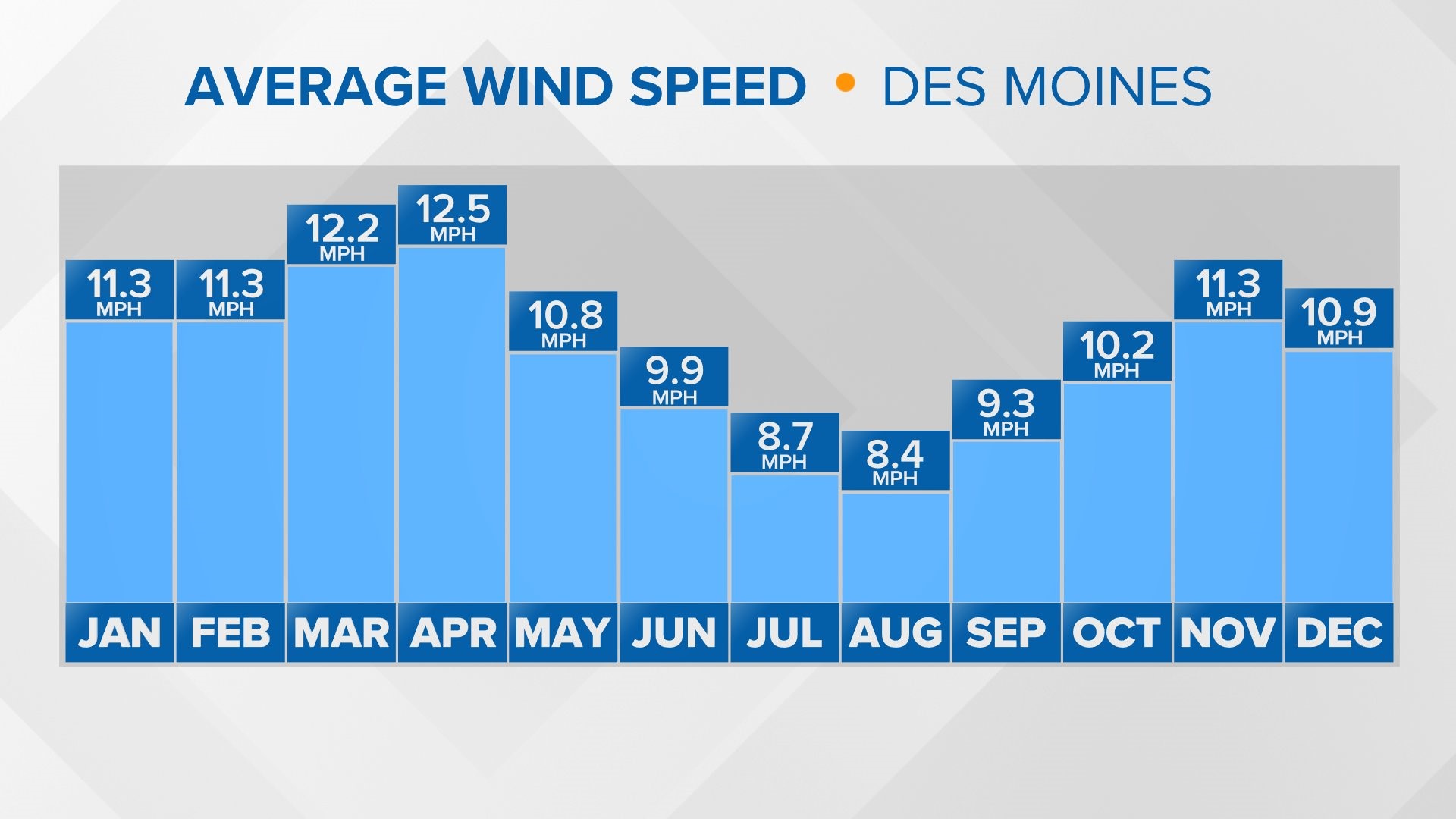
DES MOINES, Iowa — Windy weather is incredibly common in Iowa and the rest of the Midwest, especially during spring, fall and winter months.
There's always wind—moving air—outside, even if it occasionally reaches an unnoticeable speed, typically referred to as calm.
By definition, wind is the movement of air caused by the uneven heating of Earth's surface.
The sun heats the Earth at different levels in different places due to the season and time of day.
This uneven heating leads to different areas of pressure, referred to as high pressure and low pressure.
High pressure describes what happens when cooler air from higher altitude sinks down towards the Earth's surface and compresses.
Normally, areas of high pressure lead to more tranquil periods of weather. On the other hand, low pressure develops when surface air rises vertically.
Low pressure is more commonly associated with active, sometimes stormy weather.
Changes in pressure result in wind as the air naturally flows from zones of high pressure to low pressure.
More rapid changes in air pressure lead to faster winds at the surface, and are often where boundaries like cold fronts and warm fronts set up in the atmosphere.
These quick pressure rises or falls usually signal a deviation from the ongoing weather pattern.
When the pressure change is much more gradual over a larger area, the wind is generally lighter.
So why is the wind in the Midwest stronger during the fall, winter and spring, as opposed to the summer?
In summer, the jet stream—the highway in the sky responsible for steering Earth's weather patterns—frequently lifts to the north of the Midwest.
Thus, the lack of strong wind aloft in the atmosphere results in a lack of stronger wind near the Earth's surface.
By winter, the jet stream retreats to the south, creating a more active ebb and flow over the continental United States.
With stronger winds aloft in the atmosphere at this time of year, it is much easier for stronger wind to get pulled down to the surface.
By understanding how wind forms and flows, it is easy to see how interconnected the Sun and the Earth are.
Without the sun's daily heating of the Earth's surface, wind simply wouldn't exist because atmospheric pressure would remain constant.
Watch more Local 5 Weather Lab videos on YouTube