
DES MOINES, Iowa — Every so often, a rare meteorological phenomena called a heat burst causes some of the most dramatic temperature swings you will see anywhere on Earth.
A heat burst is an event characterized by a rapid increase in temperatures, along with gusty winds and a rapid decrease in humidity.
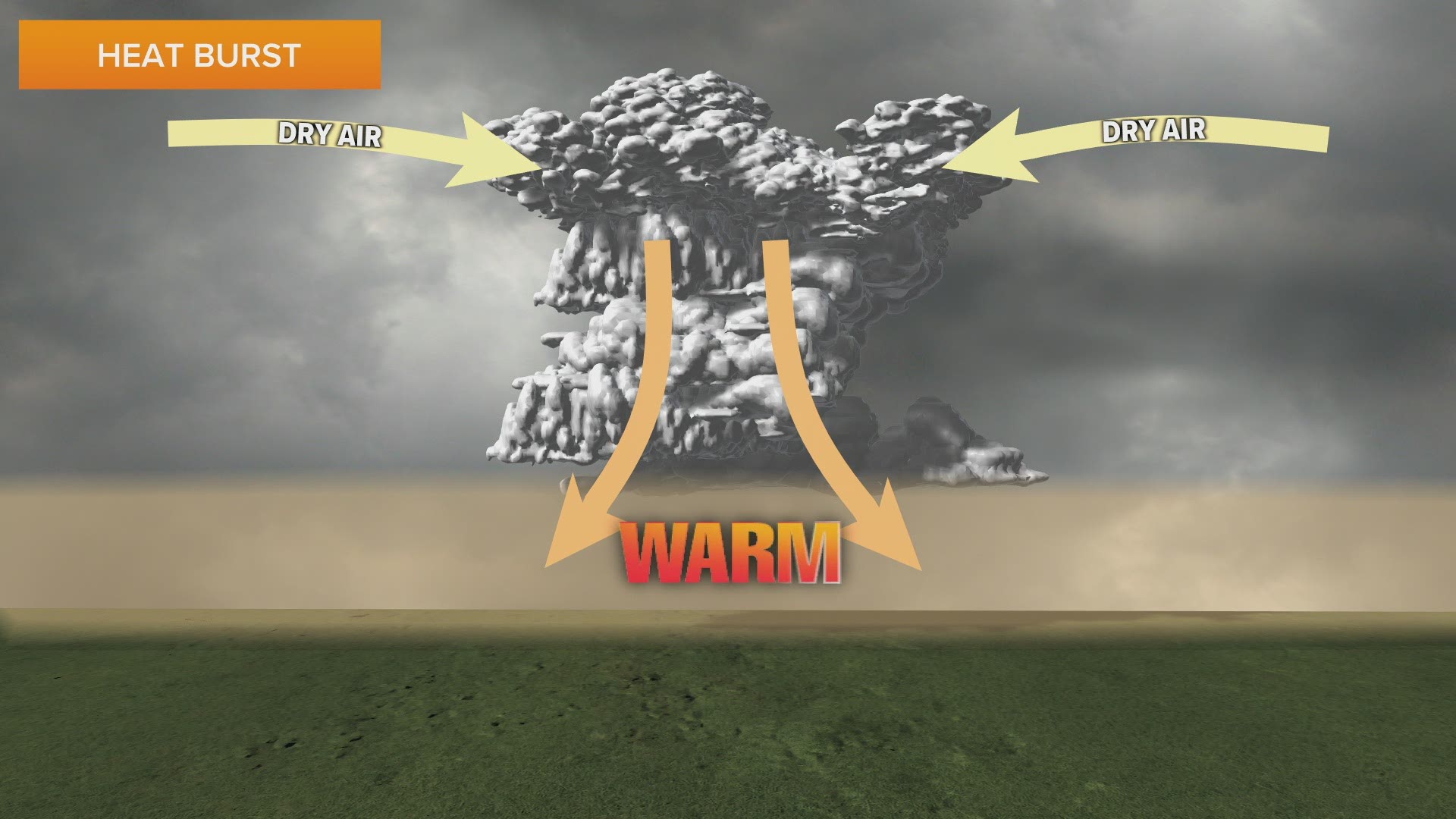
It all stems from the downdraft of a dying thunderstorm.
A typical thunderstorm contains an updraft which rises moist air high into the atmosphere and a downdraft where the rain falls.
Once the thunderstorm loses its updraft, it becomes downdraft dominant and begins to weaken.
If this happens while the mid-levels of the atmosphere contain dry air, the rain associated with the downdraft will evaporate.
This evaporation process initially cools the environment. However, the descending air will stop cooling once all the moisture has evaporated.
This is when the sinking air undergoes compressional warming, leading to a rapid temperature rise at the surface.

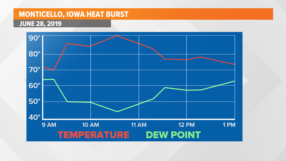
A recent example of this occurred in Monticello, Iowa on June 28, 2019.
Behind a dying line of thunderstorms, temperatures quickly rose from 70° just after 9 a.m. to 90° around 10:30 a.m.
Notice how the dew point dropped from the 60s to the 40s in the same time frame.
While this example happened in the late morning, many heat bursts occur overnight when thunderstorms most often dissipate.

One of the most extreme heat bursts on record took place in Kimberley, South Africa when temperatures rose from 67° at 9 p.m. to 110° at 9:05 p.m.
Perhaps the most infamous heat burst in the U.S. occurred on June 15, 1960 near Lake Whitney, Texas.
It is estimated that temperatures went from approximately 70° to a remarkable 140°. This dramatic warm-up coincided with 80-100 mph wind gusts, turning cotton fields into burnt stalks.