
DOWS, Iowa — Significant severe weather affected parts of Iowa on Friday, especially in the eastern half of the state.
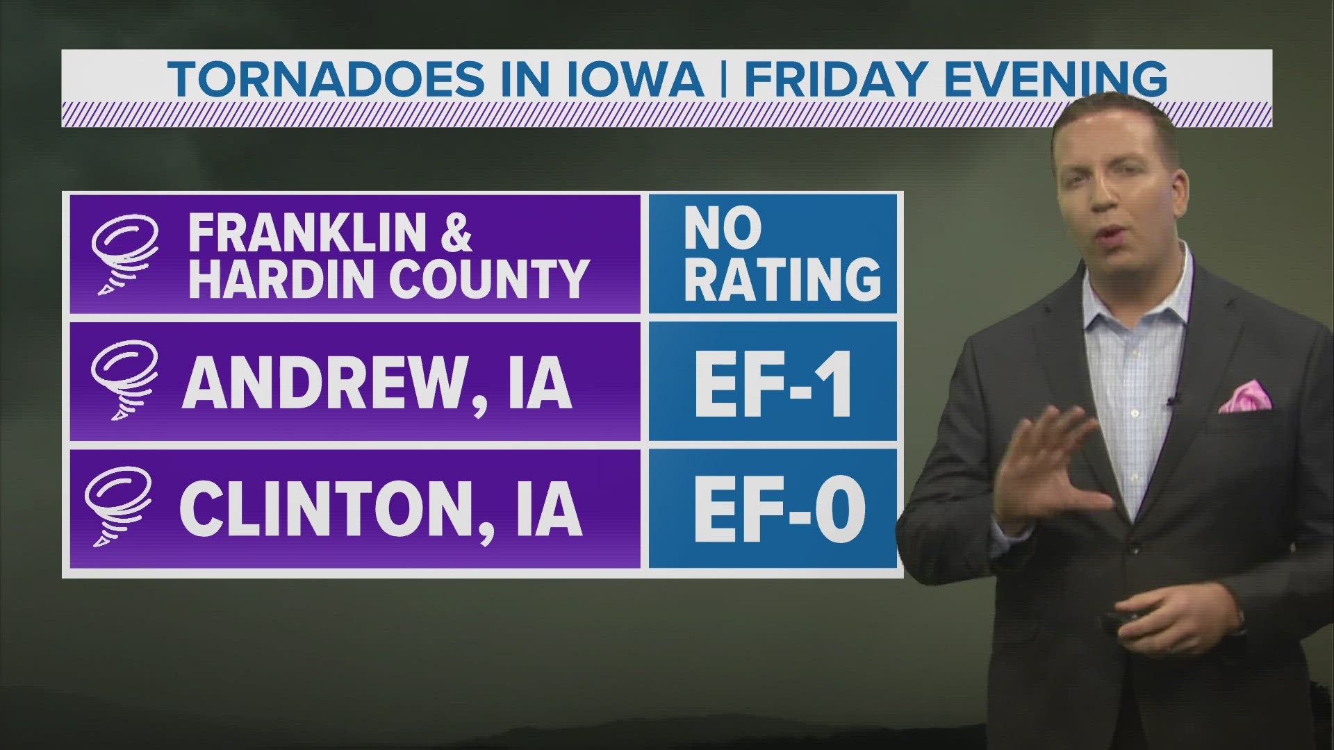
At least three tornadoes touched down statewide in the evening, including one in north-central Iowa, near the Hardin County and Franklin County line.
That tornado was originally spotted between Dows and Popejoy, but it likely stayed on the ground until it reached an area north of Iowa Falls.
It is possible the tornado may have briefly lifted during that time, however trained storm chasers reported it on the ground for several minutes.
Some minor damage occurred in the region as a result of the tornado, but the National Weather Service in Des Moines did not conduct a storm survey there on Saturday.
NWS Des Moines rated the tornado an EF-1 with peak winds around 90 mph.
The National Weather Service Quad Cities says two tornadoes also touched down in eastern Iowa, including an EF-0 near Clinton, along the Illinois border, and an EF-1 near Andrew, in Jackson County.
Andrew's EF-1 tornado likely produced maximum wind gusts around 90 mph, while the EF-0 in Clinton had gusts closer to 80 mph.
Widespread non-tornadic wind gusts also occurred around the state as the storms moved from northwest to southeast.
A whopping 93 mph gust occurred at the Marshalltown Airport, and was likely caused by a microburst near the town.
The National Weather Service defines a microburst as a 'localized column of sinking air (downdraft) within a thunderstorm'.
It is normally small in scale, less than or equal to 2.5 miles in diameter.
No injuries or fatalities were reported from Friday's severe weather in Iowa, but sporadic damage occurred.
The most common damage reported was related to downed trees and power lines.