DES MOINES, Iowa — After an unusually dry spring, summer, and early fall, it was refreshing to see above-average rainfall in October.
With several all-day rain events in October, Des Moines recorded roughly 3.5" more rainfall than the month's average of 2.8".
The city's total precipitation for October added up to 6.3", marking the sixth-wettest October since rainfall records began for Des Moines in 1878.
Wettest Octobers on record in Des Moines
- 2019 — 7.41"
- 1941 — 7.29"
- 1947 — 6.86"
- 2009 — 6.56"
- 1881 — 6.45"
- 2021 — 6.30"
An estimated 1-4" of rain fell just in the last week of October with the highest amounts falling in central and southwest Iowa.
With the recent wet weather, Des Moines dramatically improved from being the 18th driest year on record on Oct. 22 to the 51st driest on record on Oct. 31.
Although this prolonged wet weather slowed down the busy fall harvest some, data shows it will have a positive effect on farmland ahead of next year's growing season.
Most notably, the rain was important for replenishing soil moisture ahead of the 2022 season.
Data from the National Weather Service in Des Moines and the Iowa Department of Agriculture and Land Stewardship shows a positive anomaly, or deviation from average, for soil moisture when comparing the end of October to the end of September.
While helpful, it's important to note more above-average precipitation is needed over a period of several months to make up for the still existing 8-12" precipitation deficits in the driest parts of Iowa, according to Dr. Justin Glisan, Iowa's State Climatologist.
Above-average rainfall and snowfall this winter would help further improve soil moisture ahead of next year's growing season, and it would also do quite a bit to alleviate Iowa's ongoing drought.
Drought conditions in Iowa have improved since the middle of October, but the final week of wet weather has not yet been accounted for in the U.S. Drought Monitor report.
A new drought update will be issued on Thursday, Nov. 4.
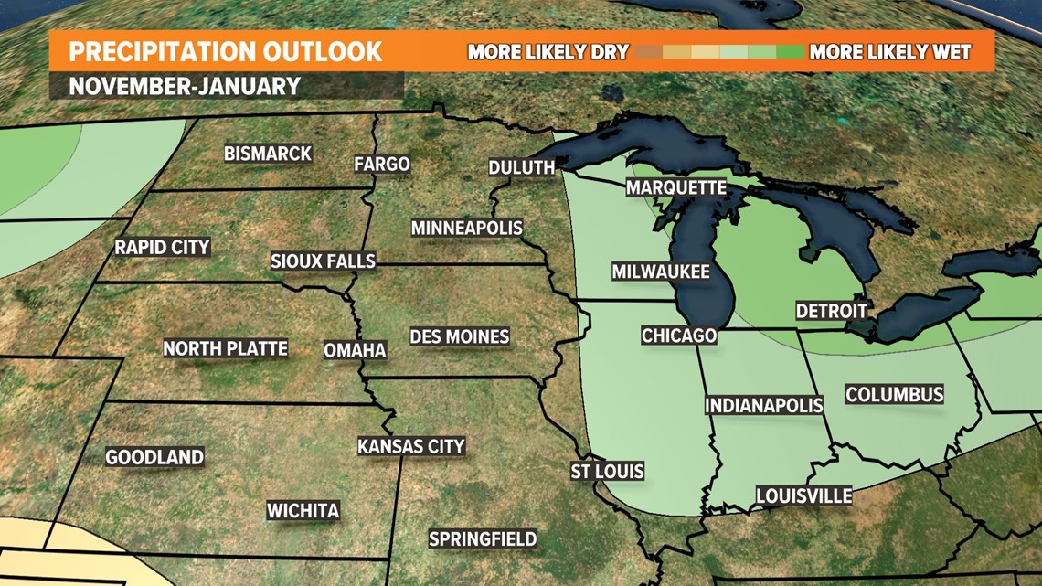
Looking forward, the U.S. Climate Prediction Center says there is an equal chance of seeing above-average precipitation or below-average precipitation from the first week of November through the end of January.
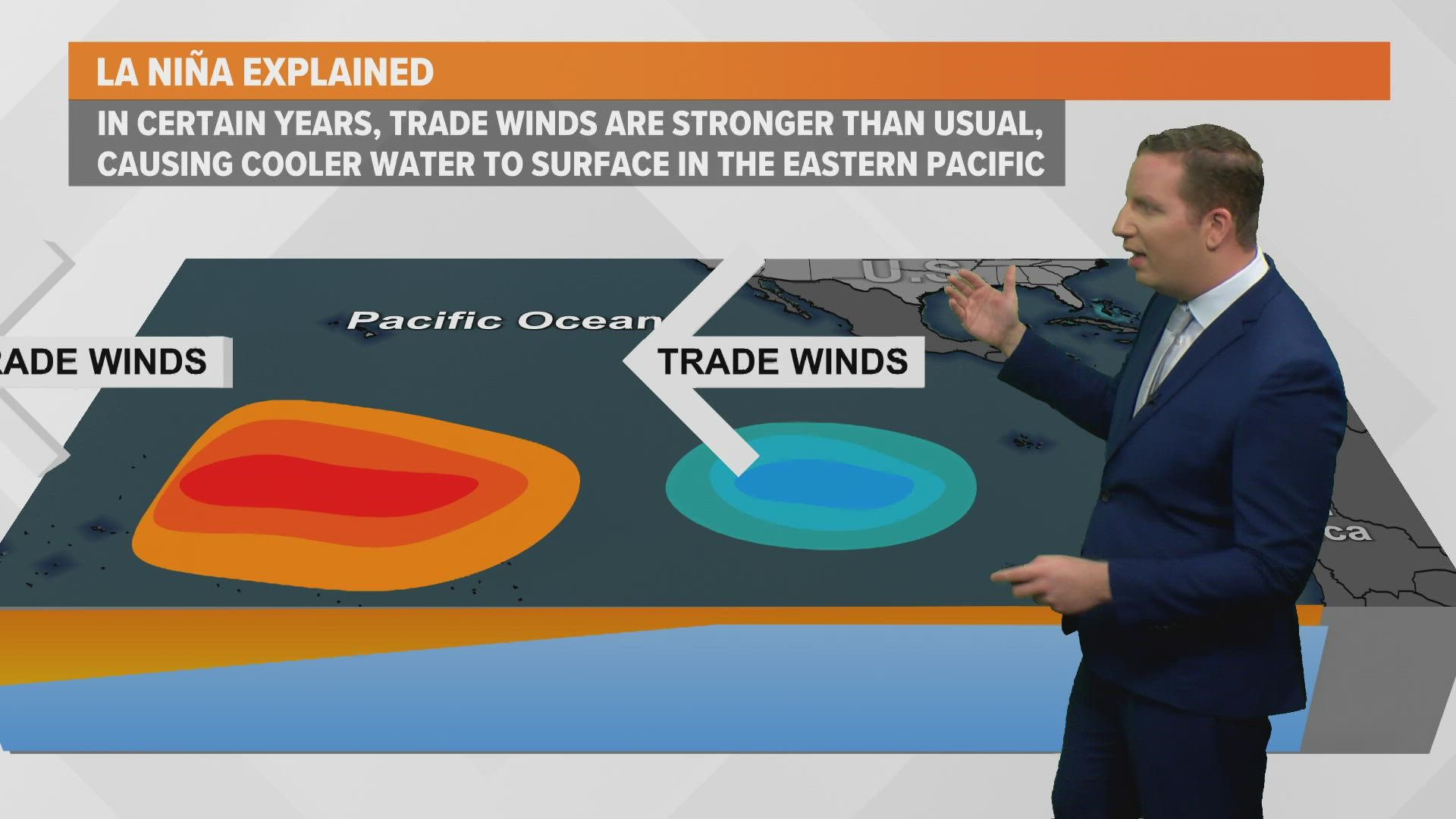
The lack of a clear signal for precipitation over the next three months is likely due to the expected La Niña pattern, which typically leads to a more active jet stream over the Midwest in the winter.